Search Term Record
Metadata
Name |
California Trail |
Related Records
-
1730 - Postcard
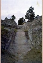
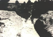
Photographic postcard of the wagon ruts cutting up the granite hill near Guernsey. Printed on the back "Oregon Trail Ruts. All wagons traveling the / Oregon and California Trails passed over this / ridge of sandstone near Guernsey, Wyoming. / In 1850, 50,000 people passed through these / ruts. / Fort Laramie National Historic Site, / Fort Laramie, Wyoming. 82212".
Record Type: Photo
-
1987.038.0001.1 - Booklet
"The Oregon-California-Mormon Trail through Natrona County," with photos, map and description of sites along the trail, prepared by the Natrona County Planning Office for the Natrona County Historic Preservation Commission.
Record Type: Archive
-
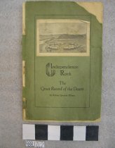
1988.017.0001.2 - Booklet
"Independence Rock: The Great Record of the Desert," by Robert Spurrier Ellison, Natrona County Historical Society, Casper, 1930. Cover and first page torn. History of the Rock and list of signatures with dates. Also with poem "Independence Rock," by Addie E. Holmberg.
Record Type: Archive
-
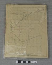
1988.048.0001.E - Map
Map of "Trails of the Old West," by William H. Jackson, reprint. Color, illustrated map with a reproduction of: "Evolution of Trails - From Animals to Aeroplane," printed at top.
Record Type: Archive
-
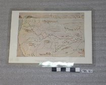
1992.001.0001 - Map
Trail Route Maps: Oregon-California Trail Pictorial Index, by Art Randall, 1988, featuring Oregon-California and Bozeman Trails in Wyoming, and with photographs on map near historic sites; Oregon Trail routes through Casper/Evansville/Mills area, with color coded trails on blown up part of the city: and map of the Bridger Trail route from Casper to Montana boarder. Oversized.
Record Type: Archive
-
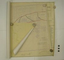
1997.036.0001 - Map
Maps of Emigrant Trails and surrounding areas. All copyright Wyoming State Archives, 1959. Scale 1" = 4 miles. Maps of: Fort Sanders; Fort Russell; Lander's Cut-Off -- both east and west sections; Parting of the Ways; and Fort Caspar/Independence Rock/South Pass.
Record Type: Archive
-
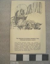
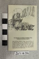
2017.015.0032 - Brochure
Fold out brochure on cream paper with illustration on front of wagon being pulled by oxen. Titled, "The Oregon-California-Mormon Trail / Through Natrona County". Unfolded, side 1 has a map and photos of historic sites along the trail route, side 2 is a listing of 13 points of interest and history text about each location, 1989.
Record Type: Archive
-
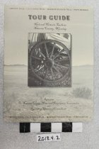
2018.004.0002 - Pamphlet
Greenish colored cover with photo of wagon wheel and a listing of the Oregon Trail, California Trail, Mormon Pioneer Trail, and Pony Express Trail. Contents include an overview of the trails, a map through the county with numbered stops and a description with text and photos of each stop along the auto tour route. Published by the Natrona County Historic Preservation Commission, 2001.
Record Type: Archive
-
2731 - Negative
Negative of the "Map of California-Oregon-Mormon Emigrant Roads featuring The Pony Express, 1860-1861," L.C. Bishop & Paul Henderson, c1959. (Folder 7)
Record Type: Photo

-
3662 - Print, Photographic
Full view of Oregon Trail ruts at Guernsey, Wyoming. Horizontal B&W.
Record Type: Photo
-
-
3664 - Print, Photographic
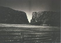
Wide view of Devil's Gate, from Sun Ranch. Horizontal B&W.
Record Type: Photo
-
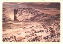
4148 - Print, Photographic
Color photograph of painting by William Henry Jackson of Devil's Gate with wagon trains in foreground.
Record Type: Photo
-
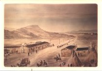
4149 - Print, Photographic
Color photograph of painting by William Henry Jackson of Deer Creek Station (near Glenrock) with trail through the center and tepees in foreground.
Record Type: Photo