Search Term Record
Metadata
Name |
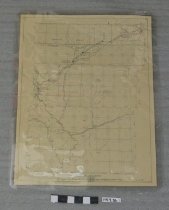
Fort Sanders |
Related Records
-
1997.036.0001 - Map
Maps of Emigrant Trails and surrounding areas. All copyright Wyoming State Archives, 1959. Scale 1" = 4 miles. Maps of: Fort Sanders; Fort Russell; Lander's Cut-Off -- both east and west sections; Parting of the Ways; and Fort Caspar/Independence Rock/South Pass.
Record Type: Archive