Search Term Record
Metadata
Name |
Reshaw Bridge |
Related Records
-
1990.009.0001 - Microfilm
Microfilm of original U.S. Army records: 2 rolls 18th U.S. Infantry Regt. returns, Jan 1863-Dec. 1870; 11th Ohio & Kansas Vol. Cavalry special orders correspondence, 1862-1866, on 2 rolls[?]; Camp Payne post returns, July 1855-April 1859, [unmarked box?]; Fort Brown- Texas, Jan 1887- Dec 1902 Post Returns; Regimental Returns roll # 162 1st US Dragoons Jan 1860-Aug 1861, 1st US Calvary Sept 1861-Dec 1866, 2nd US Calvary Jan 1864-Dec 1871; Co. I 6...
Record Type: Archive
-
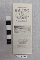
2017.023.0028 - Brochure
Quad-folded brochure concerning the history of Evansville, WY. One side has a basic map of Evansville with locations marked for historic interest. The opposite side has text about those sites: Richard (Reshaw) Bridge, Memorial Cemetery and Mausoleum, Camps Davis and Payne and Fort Clay, Stroud's Railroad Crossing and cabin, and the Mysterious concrete cross.
Record Type: Archive
-
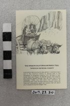
2017.023.0030 - Brochure
Multi-fold map, photos, and text of historic sites along the trails corridor through Natrona County. There is a larger map of county with an inset for the Casper area. Sites listed include: Richard's (Reshaw) Bridge, Mormon Ferry, Fort Caspar, Red Buttes Crossing, Emigrant Gap, Prospect Hill, Greasewood on Horse Creek, Steamboat Lake, Independence Rock, Devil's Gate, Martin's Cove, Split Rock.
Record Type: Archive
-
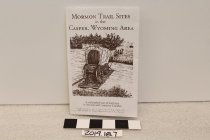
2019.018.0007 - Brochure
Mormon Trail sites guide to the Casper area published by the Casper Wyoming Stake of The Church of Jesus Christ of Latter-day Saints in 2006. Included in the brochure Douglas/Glendo area, Ayers Natural Bridge, Deer Creek/Glenrock, Edness Kimball Wilkins State Park, Richard's/Reshaw's Bridge (Evansville), Mormon Ferry - probable second site, National Trails Center, 1932 Mormon Ferry Historical Marker, Fort Caspar/Mormon Ferry, Emigrant Gap, Bessem...
Record Type: Archive